Major freezing rain storm expected to hit Montreal, prompting widespread closures
Posted March 11, 2026 7:03 am.
Last Updated March 11, 2026 12:32 pm.
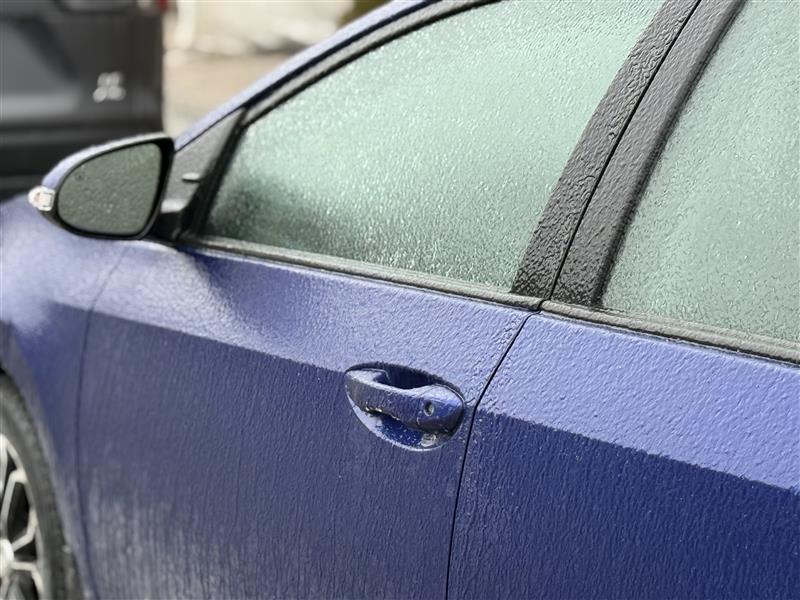
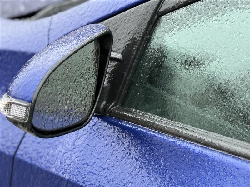
A major freezing rain storm is hitting the Montreal area Wednesday, bringing dangerous conditions, widespread closures and the potential for significant ice accumulation across southern Quebec.
Environment officials warn the system could bring 20 to 30 millimetres of freezing rain, with the event lasting up to 24 hours from Wednesday into Thursday morning. The storm is expected to impact Greater Montreal, Montérégie, Outaouais, the Laurentians, Lanaudière, Mauricie, Centre-du-Québec and the Quebec City region.
“Montreal could see between 20 and 30 millimetres of freezing rain throughout the day, which is significant and can create very hazardous conditions on roads and sidewalks,” said Giselle Dookhie, warning and preparedness meteorologist with Environment and Climate Change Canada (ECCC). “There is a possibility that freezing rain may switch over to rain later tonight or overnight, as temperatures hover around the freezing mark.”
Authorities say the heavy ice buildup could paralyze some services, cause transportation disruptions and lead to prolonged power outages as ice accumulates on trees and power lines. Roads and walkways are expected to become extremely slippery, and residents are being advised to avoid non-essential travel.

“If you do need to head out, take your time. Roads in the Montreal area are icy and slippery, and pedestrians should also be cautious and move slowly on sidewalks and walkways,” warned Dookhie. “With the amount of freezing rain expected, ice could build up on trees and power lines, which increases the risk of branches breaking and possible power outages.”
Freezing rain is falling across the Montreal region Wednesday with northeast winds of 30 km/h gusting to 50 and temperatures holding near minus –1 Celsius, with a wind chill near minus–9 C. The freezing rain is expected to change to rain this evening, while winds shift and strengthen overnight. Gusts could reach 80 km/h before Thursday morning as temperatures climb to about 5 C.
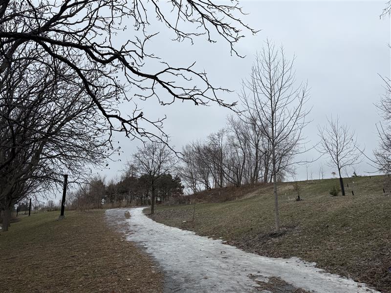
The unsettled weather will continue Thursday as the system moves out. Skies will remain cloudy with a 40 per cent chance of morning flurries, while strong west winds early in the day will gradually weaken. Temperatures are expected to fall to minus–2 C by the afternoon, with wind chills near minus–9 C.
“Once this system moves out, we could see some light snow tomorrow morning, and another round of snow is expected Friday with about two to five centimetres possible,” said Dookhie.
The wintry pattern will persist through the rest of the week and into the weekend. Increasing cloudiness Friday will bring a high near 1 C before snow develops Friday night. More snow is expected Saturday with a high around 2 C, followed by clearing skies and a low near minus–7 C overnight.
Additional snow is possible Sunday with a high near minus– 1 C, while rain moves in Monday with temperatures climbing to 7 C before colder air returns Monday night. By Tuesday, conditions are expected to improve slightly with a mix of sun and cloud and a high near minus–4 C.
“There is also the potential for more snow Sunday afternoon as another system moves through,” said Dookhie. “Even though snow in the Montreal area has already started melting, colder conditions are expected to return.”
Officials say conditions are expected to remain cold in the days following the storm, which could slow the return to normal services as ice buildup lingers across the region.
“Looking ahead to the rest of March, temperatures are expected to stay below seasonal averages, so we could still see more snow events in the forecast,” said Dookhie.
SAAQ: drive with caution
The Société de l’assurance automobile du Québec (SAAQ) has warned drivers to postpone their non-essential trips in the coming days.
SAAQ suggests doing the following to ensure optimal safety throughout the storm:
Plan your trips and consult Québec 511 to find out about road conditions.
Allow extra time for your travels.
Completely remove ice and snow from your vehicle, including the roof, headlights and license plate.
Reduce your speed and keep a safe distance from the vehicle in front of you.
Always turn on the running and low beam (the “low” headlights) as soon as the light drops.
Keep a safe distance between you and snow removal vehicles, which, it is important to remember, are surrounded by blind spots.
Stock up on windshield washer fluid and make sure your windshield wipers are in good condition.
Have a winter kit to keep in your vehicle (snow brush, scraper, windshield washer, shovel, etc.).
Expected closures
The following school boards, school service centres and schools confirmed they will be closed:
- English Montreal School Board
- Lester B. Pearson School Board
- New Frontiers School Board
- Riverside School Board
- Sir Wilfrid Laurier School Board
- Centre de services scolaire des Affluents
- Centre de services scolaire des Grandes-Seigneuries
- Centre de services scolaire des Hautes-Rivières
- Centre de services scolaire de Laval
- Centre de services scolaire Marguerite-Bourgeoys
- Centre de services scolaire Marie‑Victorin
- Centre de services scolaire des Mille-Îles
- Centre de services scolaire de Montréal
- Centre de services scolaire des Patriotes
- Centre de services scolaire de la Pointe-de-l’Île
- Centre de services scolaire de Saint-Hyacinthe
- Centre de services scolaire de Sorel-Tracy
- Centre de services scolaire des Trois-Lacs
- Abe Gold Learning Centre
- Alexander von Humboldt German International School
- École bilingue Notre Dame de Sion
- École de Formation Hébraïque
- Greaves Adventist Academy
- Hebrew Foundation School
- North Star Academy Laval
- Peter Hall School
- Summit School (all three campuses)
- Ratihén:te High School
- Rotiwennakehte Elementary School
- Villa Maria High School
The following universities and CEGEPs confirmed they will be closed on Wednesday:
Concordia University (all classes cancelled; online classes to resume as usual)
Dawson College
John Abbott College
McGill University (all classes/exams cancelled at downtown, Macdonald, and Outaouais campuses; some classes moved online)
Marianopolis College
Vanier College
CEGEP d’Ahuntsic
CEGEP André-Laurendeau
CEGEP de Bois-de-Boulogne
Collège Charlemagne
CEGEP Gérald-Godin
HEC Montréal (in-person classes cancelled; some classes to resume online)
Polytechnique Montréal
CEGEP Rosemont
Université de Montréal (in-person classes/exams cancelled)
CEGEP du Vieux Montréal
The following daycares and community centres confirmed they will be closed:
- CPE les Bois Verts
- CPE du Centre Communautaire Juif
- CPE Dollard
- CPE McGill
- CPE de Mon Coeur
- CPE Mont-Royal
- CPE Montreal Day Nursery
- CPE Les Petites Cellules
- Cummings Centre
- Garderie Alexis Nihon
- Garderie les Moments Magiques
- Garderie Vendôme
Several dozen flights that were scheduled to depart or arrive in the morning at Montreal-Trudeau airport were cancelled or delayed.
Officials say conditions are expected to remain cold in the days following the storm, which could slow the return to normal services as ice buildup lingers across the region.