How does Wednesday’s ice storm in Quebec compare to the one in 1998?
Posted April 6, 2023 3:35 pm.
Last Updated April 6, 2023 7:01 pm.
Natasha Ramsahai, Chief Meteorologist, CityNews 680, on Wednesday’s ice storm and how it compares to the 1998 ice storm.
What happened here?
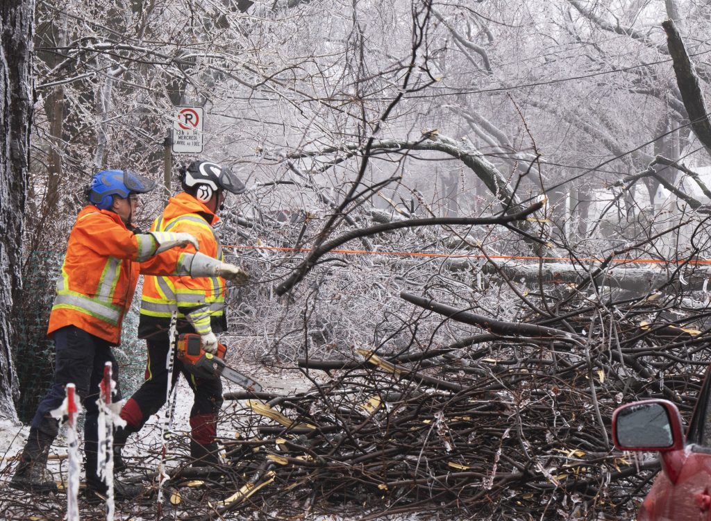
This was a Colorado low that came in. And the thing is, it has a lot of warm air that it was trying to shove towards the region, but we already had a lot of cold air sitting in place. And as we know from basic science, that cold air is more dense and it hugs the ground. So the warm air tries to get in. It overrides as we’ve got this layer of warm air on top of cold air for a prolonged period of time. It takes a lot for that to start mixing out and then switching over to rain. And that’s why we saw all of the freezing rain for a prolonged period of time because of that layering in the atmosphere that was happening. Now, this ice storm did occur so so that part again, this ice storm did occur. And yes, I am going to call it an ice storm because once we start talking about anything over 13 millimeters of ice, we start using words like crippling and major power outages and that’s over 13 millimeters. Of course, we know with this storm about 30, 35 millimeters of ice accretion was found across the city of Montreal.
Of course, when people think of ice storms in Quebec, the first thing they think of is the ice storm of 1998. Now we’re thinking this is April. This should be the time when things are warming up. But now we’re getting an ice storm. Is it comparable to back to 1998 and also is this normal for April?
Yeah, I think parents who have kids that are like teenagers, the teenagers like, wow, this is the biggest ice storm, this is amazing. And the parents are like really hold my beer. Let me explain what happened in 1998. That was a completely different kind of setup. So the ice storm from last night into today that was a Colorado low it came in yes it lasted numerous hours but it also pushed out what happened back in 1998 was a setup where we had a stationary stalled system, a system that came in and parked itself over the region. It didn’t move and that meant it was almost like train tracks this stationary front and low pressure systems just kept coming in one after the other over this same area the air mass didn’t change so it didn’t make. So you had that warm air sitting on top of cold air and we had days long freezing rain. So when we talk about 30 to 35 millimeters of ice build up with this storm, it is not comparable to 1998 where we had in some cases double or more ice in that case well over 60, 70, 80 millimeters of ice in a couple of spots, even up to 100 millimeters of ice.
Now that was 25 years ago. If you go back to 1961, that ice storm was very comparable to this one where it was about 30 to six millimeters of ice. It was still more than what we had now and again once we start talking over 13 millimeters of ice, it’s power outage time right. And trees start coming down.
So I would say this type of system doesn’t come in a lot where we get that over 20, 30, 40 millimeters of ice but on average Montreal does see freezing rain about a dozen times per year, sometimes up to 15, 16 times per year. They tend to be very short lived. You get a light glaze of ice on to surfaces, maybe a millimeter at most. But when we start talking over 30 millimeters that’s kind of a once every 20 year type of event.
When it comes to weather in Montreal for the next few days, today is warmer, what can we expect now?
We didn’t have that stalled stationary system like we did back in 1998. This was a Colorado low. It came in, it did its thing and now it has pushed out what we’re looking at over the next couple days. While we may see some flurries tonight into tomorrow morning, Montreal, just like southern Ontario, just like Ottawa, the Ottawa Valley and a good chunk of eastern Canada is in for a warm up.
We’ve got an area of high pressure rolling in and it’s almost going to be like a summertime Bermuda high. Whenever we get this high pressure that parks itself near Bermuda, we get into that southwesterly flow that is the warmest possible flow for areas along the same Lawrence. And so we’re going to be going from this freezing rain clean up and severe damage and power outages to possibly the first 20 degree days of the year coming next week.
And it’s looking to be a prolonged warm spell as well. So Easter weekend is going to be fairly sunny, but close to seasonal. But as we hit Wednesday Thursday, Friday of next week prepare for 1920, 22 and possibly even warmer degrees. It’s going to be a prolonged warm stretch here feeling like late spring and possibly early summer.