Air quality improving as rain hits Northern Quebec
Posted June 26, 2023 2:34 pm.
There was good news when it came to forest fires and their impact across the province Monday afternoon. Heavy rains have begun to fall in Témiscamingue and are heading towards critical areas of Abitibi and Nord-du-Québec, while air quality should recover in the south of the province over the afternoon.
“The situation is already improving in the Eastern Townships, where air quality has returned to good,” meteorologist Jean-Philippe Bégin told The Canadian Press in an interview on Monday.
It’s the combination of two factors that will restore air quality in southern Quebec: rain, which pushes fine particles down to the ground, and above all, the lifting of southeasterly winds, which will push these fine particles towards the northwest.
“Air quality will improve everywhere,” says the meteorologist. The Eastern Townships is the first, since the winds are coming from the southeast, but the winds have already shifted in the Montérégie as well, and this will be the case for the entire St. Lawrence Valley.
“Particles are very fine ash. Rain helps to clean the air and, finally, we have to wait for the southeast winds to work.”
RELATED
Smog and thunderstorm warnings in effect for Montreal, air quality still listed worst in the world
Quebec wildfire smoke causes widespread smog warnings, grounds some water bombers
The City of Montreal announced that its outdoor sports facilities would reopen and that its outdoor cultural activities would resume at noon on Monday.
As for the area in a state of emergency, “there’s already quite a bit of rain in Témiscamingue, and the system is moving up to reach Val-d’Or and the rest of the area (Monday) afternoon, (Monday) evening and into the night from Monday to Tuesday. Rain will fall where there are the most intense fires until Wednesday, above 40 millimetres between tonight and Wednesday in several places.”
Precipitation will be lighter in the northwest, as we approach James Bay, but it will be very present in the Normétal, Lebel-sur-Quévillon and Chibougamau areas, before moving eastwards to the Saguenay-Lac-Saint-Jean and Côte-Nord regions.
“We could exceed fifty millimetres in places”, says Jean-Philippe Bégin, a forecast that will no doubt be music to the ears of hundreds of forest firefighters and thousands of evacuated citizens.
In the longer term, forecasts indicate that the sun will return to critical areas from Wednesday to Friday, but everything seems to point to further precipitation thereafter, although it’s still too early to project that far ahead in terms of weather. One thing seems certain, however: “We’re not talking about a prolonged period of hot, dry weather, but more like a few days, without extreme heat.”
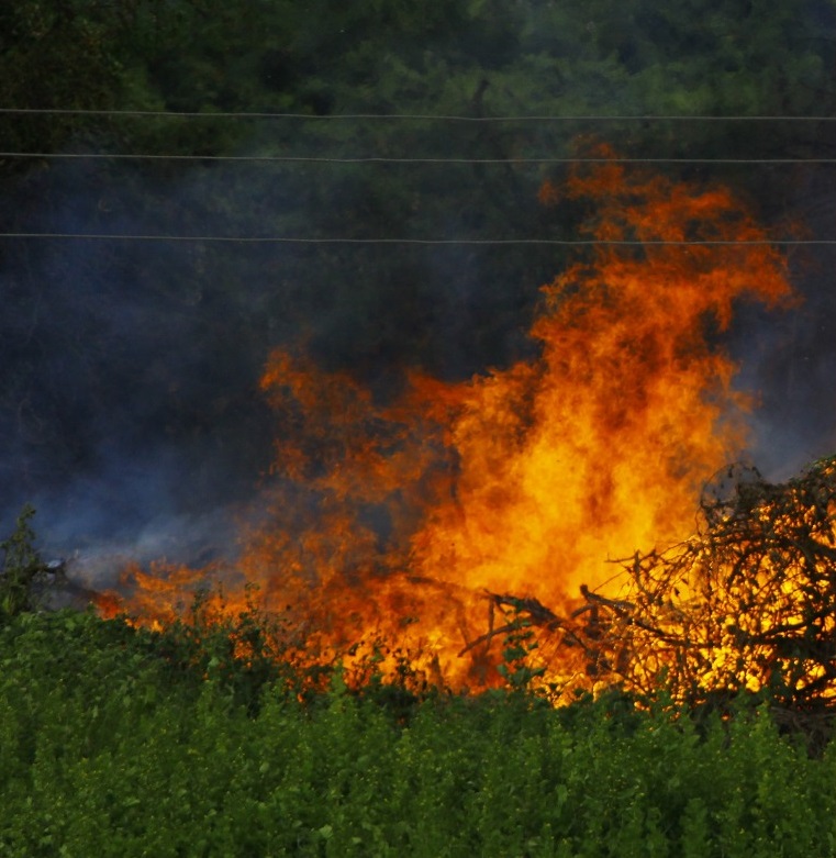
The Société de protection des forêts contre le feu (SOPFEU) is deprived of one of its most powerful tools, while smoke is so intense in the most critical areas, most air tankers and helicopters are unable to fight the flames due to reduced visibility.
SOPFEU has counted 118 fires in the region: 82 in the intensive zone, 29 of which are out of control, and 36 in the northern zone. The most worrying fire is still the Lebel-sur-Quévillon one, which, with its 380,000 hectares, represents an area ten times the size of the island of Montreal.
As a result, firefighting is taking place on the ground, using firebreaks and preventive burning. However, the agreement that brought in Spanish and Portuguese firefighters expires at the end of the week, and Quebec is in the process of concluding other agreements with additional outside reinforcements.
There was some good news for Opitciwan evacuees, who will be able to return to their homes on Tuesday.
This report by The Canadian Press was first published in French on June 26, 2023.