McGill University researcher helps create 3D scan of lost legendary ship Endurance

Posted October 15, 2024 2:08 pm.
Last Updated October 15, 2024 6:59 pm.
A McGill University researcher has helped create a 3D reconstruction of Sir Ernest Shackleton’s legendary ship, Endurance, for the first time after it was submerged in the waters of Antarctica over 100 years ago.
Associate professor of mechanical engineering James Forbes’ research group DECAR, along with Deep Ocean Search and Voyis Imaging Inc., used new subsea scanning technology composed of 25,000 high-resolution images captured when the ship was discovered in 2022.
“We found out there was an opportunity for us to use some of our navigation algorithms,” Forbes said. “That was very exciting for us, it was definitely really exciting to know that we could have an impact on this find.”

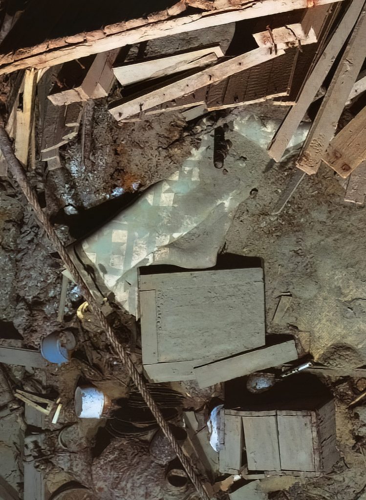
The lost vessel of Antarctic explorer Shackleton was found at at the bottom of the Weddell Sea after disappearing in 1915 and lying at a depth of 3,000 metres.
“Terrestrial navigation – cars driving on the road or even drones flying like an aircraft – they often have access to GPS,” Forbes told CityNews. “And when you have GPS, that makes the navigation problem essentially solved, if you will. Well, there’s no GPS three kilometers under the sea ice.”
Voyis Imaging Inc. says the 3D scan was produced using underwater robots that mapped the wreck from every angle, capturing thousands of photographs that were later “stitched” together to form a digital replica.

Forbes said he wasn’t part of the imaging but rather helped create the navigation mapping algorithm which helped create the 3D model using data collected from laser technology. He said being able to apply his algorithm to the 2022 discovery was a once in a lifetime opportunity.
“What my team did, my amazingly talented graduate students and I did, is we used the great laser point clouds provided by the Voyis hardware, as well as some other sensors, to essentially figure out where is the robot relative to the shipwreck, as well as creating a map of the ship essentially,” the professor explained.
Forbes’ PhD research student Mitchell Cohen says lidar technology is used to identify objects and location.
“The Endurance has a laser scanner, which is a similar type of sensor to this 3D lidar,” Cohen said while showing off a ground robot. “Then we also have two stereo cameras and these sensors are called exteroceptive sensors because they provide the robot with knowledge about the external world.”
Each sensor collects data that provides a clean image of the model, with Forbes saying the ceiling is endless with robotics and navigation algorithms. One of the main surveyors, Nico Vincent, told Forbes this is now the way of doing subsea exploration and mapping.
“So this is really, in my opinion, exciting because not only did we apply this technology and these algorithms to Endurance, but according to Nico, who is a veteran surveyor, this is now the state of the art.”
The 3D model of Endurance has been released as part of a new documentary, “Endurance,” which will offer a window into one of history’s most enduring maritime mysteries.