Montreal snowfall warning: power outages, schools closed, REM slowdown
Posted January 26, 2026 7:26 am.
Last Updated January 26, 2026 5:42 pm.
A major winter system has been rolling through the region, bringing heavy snow, blustery conditions and bitterly cold temperatures to start the week.
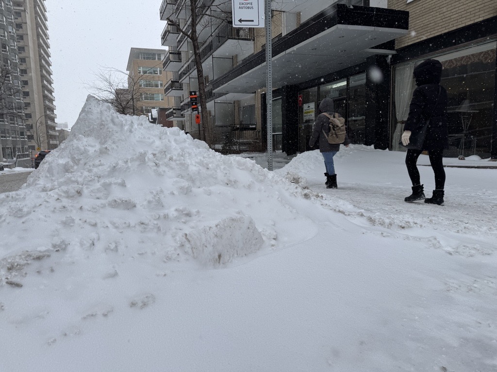
Environment and Climate Change Canada (ECCC) said total snowfall amounts of 15 to 20 centimetres were expected, with snowfall rates of one to two centimetres per hour Sunday night. Powdery snow and gusty winds will create slippery roads and could significantly impact rush-hour traffic. Motorists are advised to allow extra time for travel.
Peter Kimbell, warning preparedness meteorogist at ECCC, said the extreme cold the region experienced over the weekend was way below normal.
“We got down to minus-25 on Saturday, and Sunday we got down to minus-23, but that doesn’t tell the whole picture,” Kimbell said. “Because of course we had the wind chill, and the wind chill brought us down to a felt temperature of minus-37 on Saturday and minus-30 on Sunday.
“The average highs at the time of year are minus-6 C and the average lows are minus-15 C.”
However, even with temperatures going below minus-20 Celsius, they were above the minus-31 C record for Jan. 23 set in 1976 and minus-32.2 C record for Jan. 24 set in 1882.
Kimbell epxlains a polar vortex was responsible for the bout of cold snap. “Basically a cold outbreak of Arctic air that descended to southern Quebec and of course even further south because we saw stories of people shivering down in the States as well,” he said.
Power outages continue
Overall about 3,645 addresses were affected by a power outage in the province around 2 p.m. Monday, according to Hydro-Quebec. Montreal was the most affected with 2,839 addresses without power. On the island, Côte-Saint-Luc and the Notre-dame-de-Grâce neighbourhoods were particularly hit.
“Right now we don’t have the cause of the failure, but it happens time to time that in a substation you can have a problem with a breaker or a transformer or something like that,” explained Pascal Poinlane, a spokesperson for Hydro-Québec.
“Unfortunately, we may not be able to restore the power to every customer right now in Côte-Saint-Luc. Some of them may have to wait until tomorrow.”
READ: 66-year-old woman found dead in Montreal West apartment amid power outage and extreme cold
That left Côte-Saint-Luc residents looking for answers.
“We have kids, we have jobs, we cannot do anything right now in these conditions and we have no explanation from Hydro, nothing, zero,” said Bogdan Ion.
“It’s incredible, we’re in Canada, minus-22, 23 degrees is nothing,” added Richard. “I lived with the Crees up north, minus-40 degrees, we don’t have electrical problems like we have here. Somebody has to fix this.”

During the peak of the outage last weekend, about 15,000 addresses saw power failure Saturday morning in Montreal alone.
“Hydro-Québec understands how difficult and challenging a power outage can be during this extreme cold,” said Lynn St-Laurent, another spokesperson for the utility company. “Our crews have been working around the clock to restore the service as quickly as possible.”
Côte Saint-Luc resident Adrian Pirvulescu resorted to driving around his neighbourhood in his car to stay warm since losing power in his home Saturday around 10 a.m.
“We just drive around, yeah, and we put some gas again and we drive again and we go to check the home if the pipes are broken or stuff like this, just like that for two days,” Pirvulescu said.

St-Laurent added the weekend’s extreme cold saw some of the highest consumption of electricity of the season with 40,860 megawatts on Sunday at 5:30 p.m. However, the historical record for the highest consumption was in February 2023 when it peaked to 43,000 megawatts.
Disruptions across the region
The power outages and snowstorm forced the closure of several schools Monday, including several in the EMSB system.
On the road network, Québec 511 was already reporting several collisions and vehicles running off the road at dawn. Caution is advised on the roads, as the pavement remains snow-covered in many places.
On the Réseau express métropolitain (REM), equipment failure caused several hours of service delays between the Deux-Montagnes and Côte-de-Liesse stations.
At Montreal-Trudeau Airport, dozens of flights were cancelled on Monday morning. Most of the grounded planes were bound for other Canadian cities or the United States, which were also affected by heavy snowfall.
While the Montreal region was experiencing moderate amount snow, Toronto received record-high snow causing several flight cancellations, road accidents and other disruptions.
“We’re under a northeasterly flow, where we have been under a northeasterly flow over Southern Quebec and that over and over Lake Ontario,” Kimbell explained. “What that meant is the winds were going from the east to the west straight into Toronto on the GTA. And so that’s why they got hammered with a lot of lake effect snow, 46 to 56 in some areas, even 60 centimetres of snow.”
Weather forecast
Looking ahead for the week, ECCC’s Kimbell said, that the snow was expected to end by Monday evening. But, the cold weather from the system was here to stay.
“We have cold air that’s going to continue for the next several days — not record, bone-chilling cold that we saw on the weekend, but still below normal,” Kimbell said.
According to ECCC forecast, Monday will see five to 10 centimetres of snow that will become lighter in the evening before clearing tonight. A high of minus-13 C during the day and a low of minus-18 C with wind chill values will hover near minus–25 C in the morning, improving slightly through the afternoon as winds ease.
Tuesday will be increasingly cloudy with periods of light snow starting around noon. Temperatures will be a high minus-11 C Wind chill minus-27 C in the morning and minus-19 C in the afternoon. Nighttime will see a low of minus-18 C with clear skies.
Wednesday will be sunny during the day and cloudy in the evening, with a high of minus-11 C and low of minus-15 C.
Thursday is forecast to be similar with sun during the day and a high of minus-11 C and low of minus-17 C. Periods of snow possible at night.
Snow continues Friday with a high of minus-9 C during the day, but cloud evening with a low of minus-16 C.
— With files from The Canadian Press